 vesseltracker.com
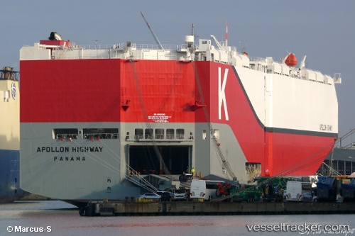
 Apollon Highway
Current Status
Where is the vessel?
Apollon Highway is currently in Near Chermside, based on AIS data received less than 1h ago.
Latest AIS update:
Current position: 27.37940° S, 153.16495° E (Near Chermside)
Average speed (last 7 days): Loading…
Average speed (last 30 days): Loading…
Vessel profile: Apollon Highway is a Vehicles Carrier with dimensions 200m x 40m.
This page combines live AIS, route history, probable destination signals, nearby traffic, and port activity for practical vessel monitoring.
The current position of vessel Apollon Highway is -27.37940 lat / 153.16495 lng. Updated: 2026-03-29 21:40:41 UTCNearest reference points:
- Near Wynnum West
- Near Hemmant
- Near Eagle Farm
Currently sailing under the flag of Panama ![]()
Details:
Live Vessel Apollon Highway Analytics (details, animations, etc.)
Recent AIS points (UTC):
2026-03-29 15:52:45 UTC · -27.37937, 153.16495 · SOG 0 kn · COG 39°2026-03-29 18:19:38 UTC · -27.37938, 153.16492 · SOG 0.1 kn · COG 39°
2026-03-29 19:37:38 UTC · -27.37936, 153.16492 · SOG 0 kn · COG 39°
2026-03-29 21:40:41 UTC · -27.37940, 153.16495 · SOG 0 kn · COG 39°