 vesseltracker.com
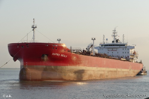
Hafnia Mikala
Current StatusWhere is the vessel?
Hafnia Mikala is currently in 154 nm NE of Coral Sea, based on AIS data received less than 1h ago.
Latest AIS update:
Current position: 17.14151° S, 152.65541° E (154 nm NE of Coral Sea)
Average speed (last 7 days): Loading…
Average speed (last 30 days): Loading…
Vessel profile: Hafnia Mikala is a Chemical Oil Products Tanker with dimensions 32m x 183m.
This page combines live AIS, route history, probable destination signals, nearby traffic, and port activity for practical vessel monitoring.
The current position of vessel Hafnia Mikala is -17.14151 lat / 152.65541 lng. Updated: 2026-04-03 14:22:59 UTCNearest reference points:
- 153 nm NE of Coral Sea
- 209 nm N of Coral Sea
Currently sailing under the flag of
Hafnia Mikala built in 0 year
Deadweight:
0 tDetails:
Live Vessel Hafnia Mikala Analytics (details, animations, etc.)
Recent AIS points (UTC):
2026-04-03 08:02:23 UTC · -16.04315, 152.54729 · SOG 10.1 kn · COG 174°2026-04-03 10:11:55 UTC · -16.41272, 152.58221 · SOG 10.4 kn · COG 176°
2026-04-03 12:19:55 UTC · -16.78620, 152.60277 · SOG 10.7 kn · COG 170°
2026-04-03 14:22:59 UTC · -17.14151, 152.65541 · SOG 10.6 kn · COG 174°