 vesseltracker.com
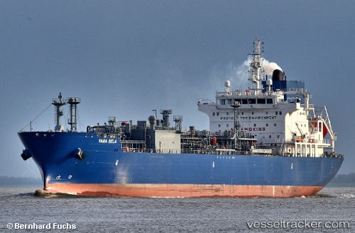
Yara Sela
Current StatusWhere is the vessel?
Yara Sela is currently in 82 nm NE of Harbour Island, based on AIS data received about 2h ago.
Latest AIS update:
Current position: 26.35333° N, 75.44833° W (82 nm NE of Harbour Island)
Average speed (last 7 days): Loading…
Average speed (last 30 days): Loading…
Vessel profile: Yara Sela is a Lpg Tanker with dimensions 26m x 160m.
This page combines live AIS, route history, probable destination signals, nearby traffic, and port activity for practical vessel monitoring.
The current position of vessel Yara Sela is 26.35333 lat / -75.44833 lng. Updated: 2026-04-01 03:20:38 UTCNearest reference points:
- 31 nm E of Harbour Island
- 22 nm E of Harbour Island
- Near Harbour Island
Details:
Live Vessel Yara Sela Analytics (details, animations, etc.)
Recent AIS points (UTC):
2026-03-31 21:50:38 UTC · 26.79500, -74.11500 · SOG 13 kn · COG -1°2026-03-31 23:29:40 UTC · 26.67333, -74.51500 · SOG 13 kn · COG -1°
2026-04-01 01:38:37 UTC · 26.50500, -75.03667 · SOG 14 kn · COG -1°
2026-04-01 03:20:38 UTC · 26.35333, -75.44833 · SOG 13 kn · COG -1°