 vesseltracker.com
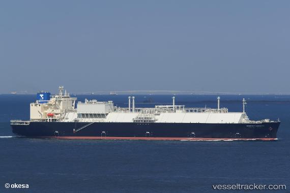
 Energy Liberty
Current Status
Where is the vessel?
Energy Liberty is currently in 40 nm N of OKUSHIRI, based on AIS data received less than 1h ago.
Latest AIS update:
Current position: 42.79287° N, 139.19276° E (40 nm N of OKUSHIRI)
Average speed (last 7 days): Loading…
Average speed (last 30 days): Loading…
Vessel profile: Energy Liberty is a Lng Tanker with dimensions 300m x 49m.
This page combines live AIS, route history, probable destination signals, nearby traffic, and port activity for practical vessel monitoring.
The current position of vessel Energy Liberty is 42.79287 lat / 139.19276 lng. Updated: 2026-04-03 20:04:51 UTCNearest reference points:
- 90 nm NW of OKUSHIRI
- Near Muroran
- 23 nm NE of SAI
Currently sailing under the flag of Japan ![]()
Details:
Live Vessel Energy Liberty Analytics (details, animations, etc.)
Recent AIS points (UTC):
2026-04-03 13:59:20 UTC · 41.89167, 139.07832 · SOG 13 kn · COG -1°2026-04-03 15:21:36 UTC · 41.64185, 139.11469 · SOG 13.4 kn · COG 12°
2026-04-03 17:41:16 UTC · 42.20667, 139.14833 · SOG 14 kn · COG -1°
2026-04-03 20:04:51 UTC · 42.79287, 139.19276 · SOG 14.7 kn · COG 359°