 vesseltracker.com
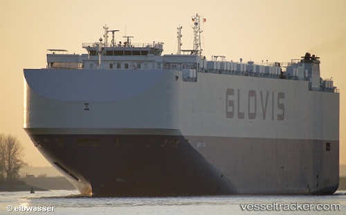
 Glovis Star
Current Status
Where is the vessel?
Glovis Star is currently in 66 nm S of Dokdo, based on AIS data received about 1h ago.
Latest AIS update:
Current position: 36.16513° N, 131.54308° E (66 nm S of Dokdo)
Average speed (last 7 days): Loading…
Average speed (last 30 days): Loading…
Vessel profile: Glovis Star is a Vehicles Carrier with dimensions 200m x 36m.
This page combines live AIS, route history, probable destination signals, nearby traffic, and port activity for practical vessel monitoring.
The current position of vessel Glovis Star is 36.16513 lat / 131.54308 lng. Updated: 2026-03-31 13:25:41 UTCNearest reference points:
- 67 nm W of NAKANOSHIMA
- 63 nm NW of Unnan
- 39 nm N of Iwami
Currently sailing under the flag of Bahamas ![]()
Details:
Live Vessel Glovis Star Analytics (details, animations, etc.)
Recent AIS points (UTC):
2026-03-31 07:58:08 UTC · 37.01605, 132.95692 · SOG 15.8 kn · COG -1°2026-03-31 09:57:57 UTC · 36.70500, 132.42500 · SOG 15 kn · COG -1°
2026-03-31 11:18:58 UTC · 36.48667, 132.09332 · SOG 15 kn · COG -1°
2026-03-31 13:25:41 UTC · 36.16513, 131.54308 · SOG 14.9 kn · COG 232°