 vesseltracker.com
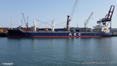
 MANTA OMER MECIT
Current Status
Where is the vessel?
MANTA OMER MECIT is currently in 37 nm SE of Sennecey-le-Grand, based on AIS data received about 1h ago.
Latest AIS update:
Current position: 46.09178° N, 4.50371° W (37 nm SE of Sennecey-le-Grand)
Average speed (last 7 days): Loading…
Average speed (last 30 days): Loading…
Vessel profile: MANTA OMER MECIT is a Cargo with dimensions m x m.
This page combines live AIS, route history, probable destination signals, nearby traffic, and port activity for practical vessel monitoring.
The current position of vessel MANTA OMER MECIT is 46.09178 lat / -4.50371 lng. Updated: 2026-03-28 06:19:53 UTCNearest reference points:
- Near Sennecey-le-Grand
- 14 nm W of Villy-le-Moutier
- Near Loctudy
Currently sailing under the flag of Marshall Islands ![]()
Details:
Live Vessel MANTA OMER MECIT Analytics (details, animations, etc.)
Recent AIS points (UTC):
2026-03-27 23:52:37 UTC · 44.98833, -3.92167 · SOG 12 kn · COG -1°2026-03-28 01:40:37 UTC · 45.32333, -4.09500 · SOG 11 kn · COG -1°
2026-03-28 03:32:13 UTC · 45.64858, -4.27854 · SOG 11.1 kn · COG 343°
2026-03-28 06:19:53 UTC · 46.09178, -4.50371 · SOG 9.5 kn · COG 342°