 vesseltracker.com
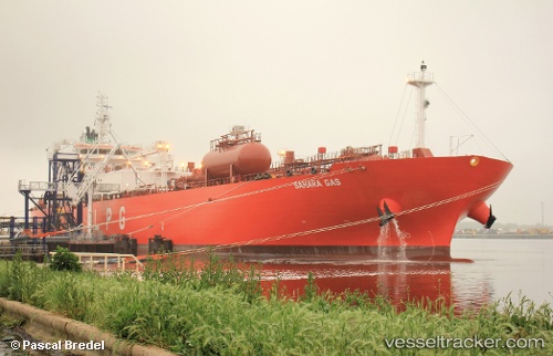
Sahara Gas
Current StatusWhere is the vessel?
Sahara Gas is currently in 232 nm SW of Cap Skiring, based on AIS data received about 1h ago.
Latest AIS update:
Current position: 9.67333° N, 19.55333° W (232 nm SW of Cap Skiring)
Average speed (last 7 days): Loading…
Average speed (last 30 days): Loading…
Vessel profile: Sahara Gas is a Lpg Tanker with dimensions 28m x 180m.
This page combines live AIS, route history, probable destination signals, nearby traffic, and port activity for practical vessel monitoring.
The current position of vessel Sahara Gas is 9.67333 lat / -19.55333 lng. Updated: 2026-03-30 13:29:52 UTCNearest reference points:
- 144 nm SW of Bubaque
- Open sea, approx. 400 nm off the nearest listed port
- Open sea, approx. 402 nm off the nearest listed port
Details:
Live Vessel Sahara Gas Analytics (details, animations, etc.)
Recent AIS points (UTC):
2026-03-30 08:02:51 UTC · 8.94167, -18.38833 · SOG 15 kn · COG -1°2026-03-30 09:35:53 UTC · 9.14667, -18.71833 · SOG 15 kn · COG -1°
2026-03-30 12:05:52 UTC · 9.48333, -19.25333 · SOG 15 kn · COG -1°
2026-03-30 13:29:52 UTC · 9.67333, -19.55333 · SOG 15 kn · COG -1°