 vesseltracker.com
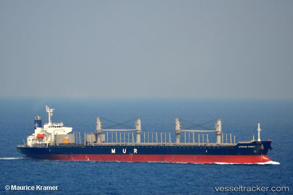
 MANTA URAZ
Current Status
Where is the vessel?
MANTA URAZ is currently in Near Melones, based on AIS data received about 3h ago.
Latest AIS update:
Current position: 8.80702° N, 79.59359° W (Near Melones)
Average speed (last 7 days): Loading…
Average speed (last 30 days): Loading…
Vessel profile: MANTA URAZ is a Cargo with dimensions m x m.
This page combines live AIS, route history, probable destination signals, nearby traffic, and port activity for practical vessel monitoring.
The current position of vessel MANTA URAZ is 8.80702 lat / -79.59359 lng. Updated: 2026-03-28 05:27:28 UTCNearest reference points:
- Near Melones
- Near Panama
- Near El Chorrillo
Currently sailing under the flag of Marshall Islands ![]()
Details:
Live Vessel MANTA URAZ Analytics (details, animations, etc.)
Recent AIS points (UTC):
2026-03-27 23:30:32 UTC · 9.00088, -79.59557 · SOG 1.5 kn · COG 138°2026-03-28 01:54:03 UTC · 8.83371, -79.47664 · SOG 9.7 kn · COG 140°
2026-03-28 04:12:40 UTC · 8.80715, -79.59380 · SOG 0.2 kn · COG 8°
2026-03-28 05:27:28 UTC · 8.80702, -79.59359 · SOG 0.1 kn · COG 5°