 vesseltracker.com
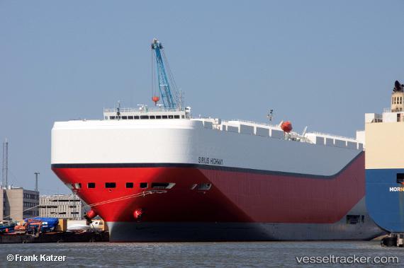
 Sirius Highway
Current Status
Where is the vessel?
Sirius Highway is currently in 283 nm E of Tsuzuki Ku, based on AIS data received less than 1h ago.
Latest AIS update:
Current position: 34.44300° N, 133.96397° W (283 nm E of Tsuzuki Ku)
Average speed (last 7 days): Loading…
Average speed (last 30 days): Loading…
Vessel profile: Sirius Highway is a Vehicles Carrier with dimensions 199m x 199m.
This page combines live AIS, route history, probable destination signals, nearby traffic, and port activity for practical vessel monitoring.
The current position of vessel Sirius Highway is 34.44300 lat / -133.96397 lng. Updated: 2026-04-01 09:58:10 UTCNearest reference points:
- Open sea, approx. 412 nm off the nearest listed port
Currently sailing under the flag of Marshall Is ![]()
Details:
Live Vessel Sirius Highway Analytics (details, animations, etc.)
Recent AIS points (UTC):
2026-04-01 03:43:59 UTC · 35.01516, -135.74403 · SOG 15.3 kn · COG 108°2026-04-01 05:28:25 UTC · 34.85688, -135.24289 · SOG 15.5 kn · COG 108°
2026-04-01 08:20:47 UTC · 34.59167, -134.41667 · SOG 14 kn · COG -1°
2026-04-01 09:58:10 UTC · 34.44300, -133.96397 · SOG 15.1 kn · COG 109°