 vesseltracker.com
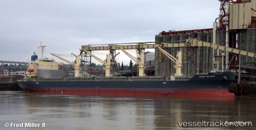
 Cebu Island
Current Status
Where is the vessel?
Cebu Island is currently in Near Kawasaki, based on AIS data received about 2h ago.
Latest AIS update:
Current position: 35.50006° N, 139.73187° E (Near Kawasaki)
Average speed (last 7 days): Loading…
Average speed (last 30 days): Loading…
Vessel profile: Cebu Island is a General Cargo Ship with dimensions 180m x 180m.
This page combines live AIS, route history, probable destination signals, nearby traffic, and port activity for practical vessel monitoring.
The current position of vessel Cebu Island is 35.50006 lat / 139.73187 lng. Updated: 2026-04-02 11:22:14 UTCNearest reference points:
- Near Kawasaki
- Near Yokohama
- Near Aomi
Currently sailing under the flag of Panama ![]()
Details:
Live Vessel Cebu Island Analytics (details, animations, etc.)
Recent AIS points (UTC):
2026-04-02 06:13:09 UTC · 35.50011, 139.73184 · SOG 0 kn · COG 355°2026-04-02 07:55:12 UTC · 35.50007, 139.73181 · SOG 0 kn · COG 355°
2026-04-02 10:10:08 UTC · 35.50010, 139.73186 · SOG 0 kn · COG 355°
2026-04-02 11:22:14 UTC · 35.50006, 139.73187 · SOG 0 kn · COG 355°