 vesseltracker.com
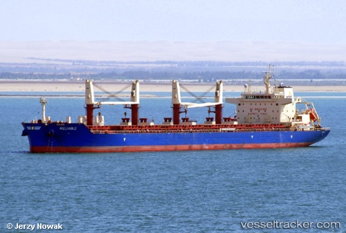
 RELIABLE
Current Status
Where is the vessel?
RELIABLE is currently in Near NADOR, based on AIS data received about 1h ago.
Latest AIS update:
Current position: 35.27701° N, 2.91541° W (Near NADOR)
Average speed (last 7 days): Loading…
Average speed (last 30 days): Loading…
Vessel profile: RELIABLE is a Cargo with dimensions m x m.
This page combines live AIS, route history, probable destination signals, nearby traffic, and port activity for practical vessel monitoring.
The current position of vessel RELIABLE is 35.27701 lat / -2.91541 lng. Updated: 2026-03-31 11:24:03 UTCNearest reference points:
- 28 nm N of Melilla
- 37 nm S of Las Noras de Daza
- 29 nm S of Carchuna
Currently sailing under the flag of Liberia ![]()
Details:
Live Vessel RELIABLE Analytics (details, animations, etc.)
Recent AIS points (UTC):
2026-03-31 06:03:03 UTC · 35.27704, -2.91541 · SOG 0 kn · COG 321°2026-03-31 07:27:03 UTC · 35.27701, -2.91538 · SOG 0.1 kn · COG 321°
2026-03-31 09:42:03 UTC · 35.27702, -2.91542 · SOG 0.1 kn · COG 321°
2026-03-31 11:24:03 UTC · 35.27701, -2.91541 · SOG 0 kn · COG 321°