 vesseltracker.com
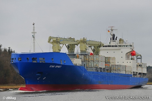
 STAR SPIRIT
Current Status
Where is the vessel?
STAR SPIRIT is currently in 16 nm N of Hijum, based on AIS data received about 1h ago.
Latest AIS update:
Current position: 53.56946° N, 4.78350° E (16 nm N of Hijum)
Average speed (last 7 days): Loading…
Average speed (last 30 days): Loading…
Vessel profile: STAR SPIRIT is a Cargo with dimensions m x m.
This page combines live AIS, route history, probable destination signals, nearby traffic, and port activity for practical vessel monitoring.
The current position of vessel STAR SPIRIT is 53.56946 lat / 4.78350 lng. Updated: 2026-04-08 05:58:25 UTCNearest reference points:
- Near Molengat
- Near de Waal
- Near OUDESCHILD
Currently sailing under the flag of Bahamas ![]()
Details:
Live Vessel STAR SPIRIT Analytics (details, animations, etc.)
Recent AIS points (UTC):
2026-04-08 00:03:06 UTC · 52.30704, 3.39773 · SOG 15.2 kn · COG 49°2026-04-08 01:44:54 UTC · 52.60944, 3.90057 · SOG 15.5 kn · COG 43°
2026-04-08 03:23:42 UTC · 52.95567, 4.30354 · SOG 15.8 kn · COG 25°
2026-04-08 05:58:25 UTC · 53.56946, 4.78350 · SOG 16.1 kn · COG 26°