 vesseltracker.com
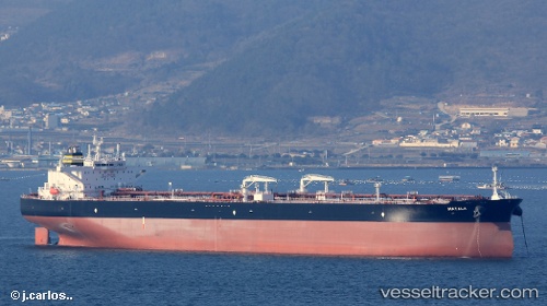
Matala
Current StatusWhere is the vessel?
Matala is currently in 278 nm SW of Benahavis, based on AIS data received less than 1h ago.
Latest AIS update:
Current position: 33.45308° N, 54.74396° W (278 nm SW of Benahavis)
Average speed (last 7 days): Loading…
Average speed (last 30 days): Loading…
Vessel profile: Matala is a Crude Oil Tanker with dimensions 49m x 279m.
This page combines live AIS, route history, probable destination signals, nearby traffic, and port activity for practical vessel monitoring.
The current position of vessel Matala is 33.45308 lat / -54.74396 lng. Updated: 2026-04-02 03:38:38 UTCNearest reference points:
- 244 nm SW of Benahavis
Details:
Live Vessel Matala Analytics (details, animations, etc.)
Recent AIS points (UTC):
2026-04-01 21:28:33 UTC · 34.01833, -53.39833 · SOG 12 kn · COG -1°2026-04-01 23:33:27 UTC · 33.83104, -53.85710 · SOG 12.2 kn · COG 241°
2026-04-02 01:55:31 UTC · 33.61333, -54.37333 · SOG 12 kn · COG -1°
2026-04-02 03:38:38 UTC · 33.45308, -54.74396 · SOG 12.2 kn · COG 243°