 vesseltracker.com
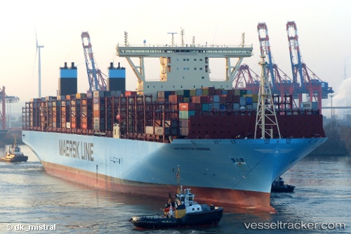
Manchester Maersk
Current StatusWhere is the vessel?
Manchester Maersk is currently in 268 nm W of Bolinao, based on AIS data received about 1h ago.
Latest AIS update:
Current position: 16.13333° N, 115.24667° E (268 nm W of Bolinao)
Average speed (last 7 days): Loading…
Average speed (last 30 days): Loading…
Vessel profile: Manchester Maersk is a Container Ship with dimensions 58m x 399m.
This page combines live AIS, route history, probable destination signals, nearby traffic, and port activity for practical vessel monitoring.
The current position of vessel Manchester Maersk is 16.13333 lat / 115.24667 lng. Updated: 2026-04-20 01:51:03 UTCNearest reference points:
- 222 nm W of Iba
- 282 nm E of Tan Cang Qui Nhon
- 215 nm NE of Tan Cang Qui Nhon
Details:
Live Vessel Manchester Maersk Analytics (details, animations, etc.)
Recent AIS points (UTC):
2026-04-19 22:56:37 UTC · 16.89333, 115.78333 · SOG 19 kn · COG -1°2026-04-19 23:48:24 UTC · 16.65867, 115.62672 · SOG 19.1 kn · COG 215°
2026-04-20 01:51:03 UTC · 16.13333, 115.24667 · SOG 19 kn · COG -1°
2026-04-20 01:51:03 UTC · 16.13333, 115.24667 · SOG 19 kn · COG -1°