 vesseltracker.com
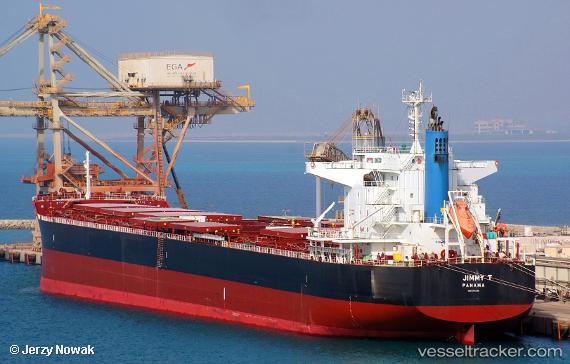
Jimmy T
Current StatusWhere is the vessel?
Jimmy T is currently in 92 nm E of Ebene, based on AIS data received about 1h ago.
Latest AIS update:
Current position: 20.68432° S, 59.34144° E (92 nm E of Ebene)
Average speed (last 7 days): Loading…
Average speed (last 30 days): Loading…
Vessel profile: Jimmy T is a Bulk Carrier with dimensions 32m x 228m.
This page combines live AIS, route history, probable destination signals, nearby traffic, and port activity for practical vessel monitoring.
The current position of vessel Jimmy T is -20.68432 lat / 59.34144 lng. Updated: 2026-04-12 15:33:50 UTCNearest reference points:
- 159 nm W of Rodrigues
- Near Port Louis
- 61 nm NW of Al Azaiba
Details:
Live Vessel Jimmy T Analytics (details, animations, etc.)
Recent AIS points (UTC):
2026-04-12 10:27:47 UTC · -21.23268, 58.47980 · SOG 11.2 kn · COG 53°2026-04-12 12:10:47 UTC · -21.04397, 58.76484 · SOG 11.5 kn · COG 56°
2026-04-12 14:03:08 UTC · -20.84310, 59.08080 · SOG 11.4 kn · COG 58°
2026-04-12 15:33:50 UTC · -20.68432, 59.34144 · SOG 11.6 kn · COG 58°