 vesseltracker.com
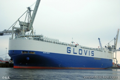
Glovis Safety
Current StatusWhere is the vessel?
Glovis Safety is currently in Open sea, approx. 415 nm off the nearest listed port, based on AIS data received about 2h ago.
Latest AIS update:
Current position: 5.34427° S, 7.91255° W (Open sea, approx. 415 nm off the nearest listed port)
Average speed (last 7 days): Loading…
Average speed (last 30 days): Loading…
Vessel profile: Glovis Safety is a Vehicles Carrier with dimensions 32m x 230m.
This page combines live AIS, route history, probable destination signals, nearby traffic, and port activity for practical vessel monitoring.
The current position of vessel Glovis Safety is -5.34427 lat / -7.91255 lng. Updated: 2026-04-01 13:27:53 UTCNearest reference points:
- Open sea, approx. 415 nm off the nearest listed port
- Open sea, approx. 419 nm off the nearest listed port
- Open sea, approx. 416 nm off the nearest listed port
Details:
Live Vessel Glovis Safety Analytics (details, animations, etc.)
Recent AIS points (UTC):
2026-04-01 07:29:53 UTC · -6.67830, -6.80187 · SOG 17.2 kn · COG 322°2026-04-01 10:28:20 UTC · -6.01592, -7.35173 · SOG 17.5 kn · COG 321°
2026-04-01 11:22:19 UTC · -5.81419, -7.52076 · SOG 17.3 kn · COG 321°
2026-04-01 13:27:53 UTC · -5.34427, -7.91255 · SOG 17.3 kn · COG 320°