 vesseltracker.com
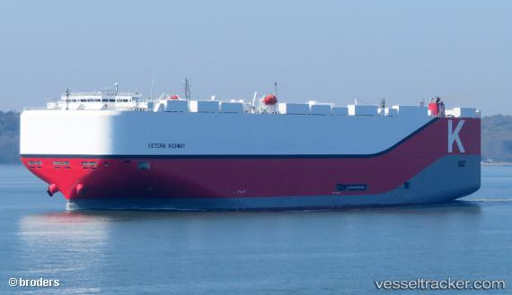
 Victoria Highway
Current Status
Where is the vessel?
Victoria Highway is currently in 203 nm N of Barcarena, based on AIS data received less than 1h ago.
Latest AIS update:
Current position: 2.87046° N, 46.95215° W (203 nm N of Barcarena)
Average speed (last 7 days): Loading…
Average speed (last 30 days): Loading…
Vessel profile: Victoria Highway is a Vehicles Carrier with dimensions 199m x 199m.
This page combines live AIS, route history, probable destination signals, nearby traffic, and port activity for practical vessel monitoring.
The current position of vessel Victoria Highway is 2.87046 lat / -46.95215 lng. Updated: 2026-04-08 10:23:27 UTCNearest reference points:
- 227 nm W of Juazeiro-Pi
Currently sailing under the flag of Panama ![]()
Details:
Live Vessel Victoria Highway Analytics (details, animations, etc.)
Recent AIS points (UTC):
2026-04-08 03:47:29 UTC · 3.77192, -48.35217 · SOG 15.2 kn · COG 117°2026-04-08 06:02:24 UTC · 3.46731, -47.87725 · SOG 14.9 kn · COG 116°
2026-04-08 07:38:31 UTC · 3.24693, -47.53717 · SOG 14.8 kn · COG 119°
2026-04-08 10:23:27 UTC · 2.87046, -46.95215 · SOG 15.2 kn · COG 119°