 vesseltracker.com
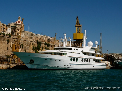
Vessel My Maridome IMO: 1002641, MMSI: 235241000 Yacht
UTC, 41.52857, 2.44465, course: 66, speed: 0.2
UTC, 41.52857, 2.44467, course: 66, speed: 0.1
2026-02-16 13:33:09 UTC, 41.52853, 2.44465, course: 66, speed: 0.1
Live AIS position:
UTC. Near MATARO),
updated 2026-02-16 13:33:09 UTC.
Find the position of the vessel My Maridome on the map. The latter are known coordinates and path.
marine traffic ship tracker show on live map
The current position of vessel My Maridome is 41.52853 lat / 2.44465 lng. Updated: 2026-02-16 13:33:09 UTCCurrently sailing under the flag of United Kingdom
My Maridome built in 1989 year
Details:
Last coordinates of the vessel:
UTC, 41.52852, 2.44473, course: 66, speed: 0.1UTC, 41.52857, 2.44465, course: 66, speed: 0.2
UTC, 41.52857, 2.44467, course: 66, speed: 0.1
2026-02-16 13:33:09 UTC, 41.52853, 2.44465, course: 66, speed: 0.1