 vesseltracker.com
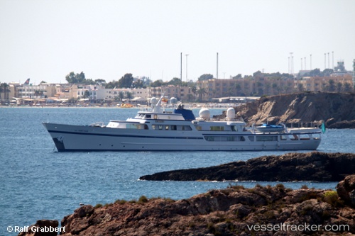
Al Diriyah
Current StatusWhere is the vessel?
Al Diriyah is currently in 11 nm N of Tusdeer Free Zone, based on AIS data received less than 1h ago.
Latest AIS update:
Current position: 21.66510° N, 39.09583° E (11 nm N of Tusdeer Free Zone)
Average speed (last 7 days): Loading…
Average speed (last 30 days): Loading…
Vessel profile: Al Diriyah is a Yacht with dimensions 11m x 80m.
This page combines live AIS, route history, probable destination signals, nearby traffic, and port activity for practical vessel monitoring.
The current position of vessel Al Diriyah is 21.66510 lat / 39.09583 lng. Updated: 2026-04-05 23:27:00 UTCNearest reference points:
- 14 nm N of Tusdeer Free Zone
- Near Tusdeer Free Zone
- 22 nm N of Tusdeer Free Zone
Details:
Live Vessel Al Diriyah Analytics (details, animations, etc.)
Recent AIS points (UTC):
2026-04-05 18:18:02 UTC · 21.66515, 39.09582 · SOG 0 kn · COG 168°2026-04-05 20:08:59 UTC · 21.66512, 39.09582 · SOG 0 kn · COG 168°
2026-04-05 22:09:00 UTC · 21.66512, 39.09583 · SOG 0 kn · COG 169°
2026-04-05 23:27:00 UTC · 21.66510, 39.09583 · SOG 0 kn · COG 169°