 vesseltracker.com
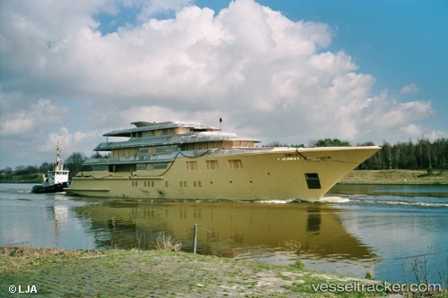
 DEJA TOO
Current Status
Where is the vessel?
DEJA TOO is currently in Near Saint George, based on AIS data received less than 1h ago.
Latest AIS update:
Current position: 32.37847° N, 64.68132° W (Near Saint George)
Average speed (last 7 days): Loading…
Average speed (last 30 days): Loading…
Vessel profile: DEJA TOO is a Houseboat with dimensions 52m x 9m.
This page combines live AIS, route history, probable destination signals, nearby traffic, and port activity for practical vessel monitoring.
The current position of vessel DEJA TOO is 32.37847 lat / -64.68132 lng. Updated: 2026-04-21 01:30:46 UTCCurrently sailing under the flag of Cayman Islands ![]()
DEJA TOO built in 2003 year
Deadweight:
134 tDetails:
Live Vessel DEJA TOO Analytics (details, animations, etc.)
Recent AIS points (UTC):
2026-04-20 22:42:43 UTC · 32.37848, -64.68133 · SOG 0 kn · COG 67°2026-04-21 00:00:45 UTC · 32.37847, -64.68131 · SOG 0 kn · COG 67°
2026-04-21 01:24:50 UTC · 32.37848, -64.68131 · SOG 0 kn · COG 67°
2026-04-21 01:30:46 UTC · 32.37847, -64.68132 · SOG 0 kn · COG 67°