 vesseltracker.com
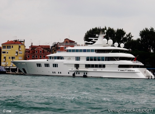
Lady E
Current StatusWhere is the vessel?
Lady E is currently in 307 nm E of Amurang, based on AIS data received less than 1h ago.
Latest AIS update:
Current position: 0.02324° S, 119.59090° W (307 nm E of Amurang)
Average speed (last 7 days): Loading…
Average speed (last 30 days): Loading…
Vessel profile: Lady E is a Service Ship with dimensions 12m x 69m.
This page combines live AIS, route history, probable destination signals, nearby traffic, and port activity for practical vessel monitoring.
The current position of vessel Lady E is -0.02324 lat / -119.59090 lng. Updated: 2026-04-18 04:09:59 UTCNearest reference points:
- Open sea, approx. 400 nm off the nearest listed port
- Open sea, approx. 402 nm off the nearest listed port
- Open sea, approx. 403 nm off the nearest listed port
Details:
Live Vessel Lady E Analytics (details, animations, etc.)
Recent AIS points (UTC):
2026-04-17 21:34:06 UTC · -0.04333, -121.42833 · SOG 16 kn · COG -1°2026-04-17 23:43:21 UTC · -0.03831, -120.83012 · SOG 16.3 kn · COG 93°
2026-04-18 02:01:45 UTC · -0.02981, -120.18950 · SOG 16.5 kn · COG 93°
2026-04-18 04:09:59 UTC · -0.02324, -119.59090 · SOG 16.6 kn · COG 93°