 vesseltracker.com
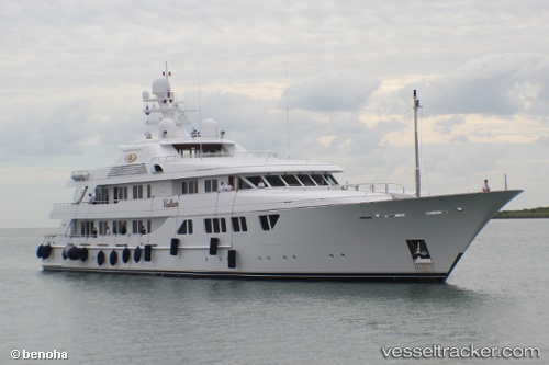
Vessel Callisto IMO: 1008566, MMSI: 319137800 Service Ship
UTC, 24.36783, -76.64065, course: 102, speed: 0
UTC, 24.36804, -76.64057, course: 151, speed: 0.1
2026-02-27 09:53:50 UTC, 24.36805, -76.64060, course: 145, speed: 0
Live AIS position:
UTC. 30 nm SW of Miller Anchorage),
updated 2026-02-27 09:53:50 UTC.
Find the position of the vessel Callisto on the map. The latter are known coordinates and path.
marine traffic ship tracker show on live map
The current position of vessel Callisto is 24.36805 lat / -76.64060 lng. Updated: 2026-02-27 09:53:50 UTCCurrently sailing under the flag of Cayman Is
Callisto built in 2006 year
Deadweight:
1228 tDetails:
Last coordinates of the vessel:
UTC, 24.36767, -76.64067, course: 68, speed: 0UTC, 24.36783, -76.64065, course: 102, speed: 0
UTC, 24.36804, -76.64057, course: 151, speed: 0.1
2026-02-27 09:53:50 UTC, 24.36805, -76.64060, course: 145, speed: 0