 vesseltracker.com
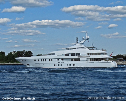
 C Star
Current Status
Where is the vessel?
C Star is currently in Near Saint-Barthélemy, based on AIS data received about 2h ago.
Latest AIS update:
Current position: 17.88965° N, 62.85030° W (Near Saint-Barthélemy)
Average speed (last 7 days): Loading…
Average speed (last 30 days): Loading…
Vessel profile: C Star is a Service Ship with dimensions 60m x 11m.
This page combines live AIS, route history, probable destination signals, nearby traffic, and port activity for practical vessel monitoring.
The current position of vessel C Star is 17.88965 lat / -62.85030 lng. Updated: 2026-04-20 19:23:41 UTCNearest reference points:
- Near GUSTAVIA
- Near ST MAARTEN
- Near Saint John's
Currently sailing under the flag of Cayman Is ![]()
C Star built in 2006 year
Deadweight:
217 tDetails:
Live Vessel C Star Analytics (details, animations, etc.)
Recent AIS points (UTC):
2026-04-20 16:47:37 UTC · 17.88922, -62.85115 · SOG 0.6 kn · COG 74°2026-04-20 17:32:42 UTC · 17.88956, -62.85019 · SOG 0.4 kn · COG 182°
2026-04-20 19:17:42 UTC · 17.88951, -62.85042 · SOG 0.2 kn · COG 133°
2026-04-20 19:23:41 UTC · 17.88965, -62.85030 · SOG 0.1 kn · COG 120°