 vesseltracker.com
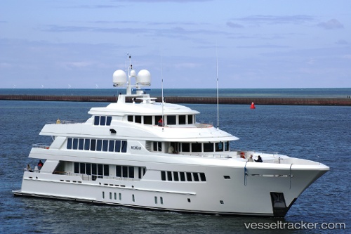
Mirgab Vi
Current StatusWhere is the vessel?
Mirgab Vi is currently in Near Barcelona, based on AIS data received less than 1h ago.
Latest AIS update:
Current position: 41.37555° N, 2.18601° E (Near Barcelona)
Average speed (last 7 days): Loading…
Average speed (last 30 days): Loading…
Vessel profile: Mirgab Vi is a Service Ship with dimensions 9m x 49m.
This page combines live AIS, route history, probable destination signals, nearby traffic, and port activity for practical vessel monitoring.
The current position of vessel Mirgab Vi is 41.37555 lat / 2.18601 lng. Updated: 2026-04-20 09:47:15 UTCNearest reference points:
- Near Barcelona
- Near Zona Franca de Barcelona
- Near BADALONA
Details:
Live Vessel Mirgab Vi Analytics (details, animations, etc.)
Recent AIS points (UTC):
2026-04-20 05:59:18 UTC · 41.37554, 2.18603 · SOG 0 kn · COG 284°2026-04-20 07:16:18 UTC · 41.37554, 2.18600 · SOG 0 kn · COG 285°
2026-04-20 07:35:17 UTC · 41.37556, 2.18600 · SOG 0 kn · COG 284°
2026-04-20 09:47:15 UTC · 41.37555, 2.18601 · SOG 0 kn · COG 285°