 vesseltracker.com
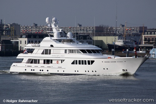
 Kahalani
Current Status
Where is the vessel?
Kahalani is currently in Near Canning Town, based on AIS data received less than 1h ago.
Latest AIS update:
Current position: 51.50167° N, 0.01167° W (Near Canning Town)
Average speed (last 7 days): Loading…
Average speed (last 30 days): Loading…
Vessel profile: Kahalani is a Service Ship with dimensions 55m x 10m.
This page combines live AIS, route history, probable destination signals, nearby traffic, and port activity for practical vessel monitoring.
The current position of vessel Kahalani is 51.50167 lat / -0.01167 lng. Updated: 2026-04-21 22:35:08 UTCNearest reference points:
- Near Blackheath/London
- Near Gravesend
- Near GILLINGHAM
Currently sailing under the flag of Malta ![]()
Kahalani built in 2010 year
Details:
Live Vessel Kahalani Analytics (details, animations, etc.)
Recent AIS points (UTC):
2026-04-21 19:01:26 UTC · 51.50127, -0.01262 · SOG 0 kn · COG 100°2026-04-21 19:22:26 UTC · 51.50104, -0.01314 · SOG 0 kn · COG 100°
2026-04-21 21:31:27 UTC · 51.50146, -0.01332 · SOG 0 kn · COG 100°
2026-04-21 22:35:08 UTC · 51.50167, -0.01167 · SOG 0 kn · COG -1°