 vesseltracker.com
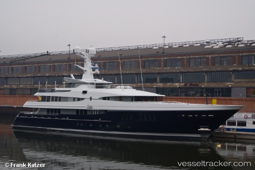
 Kaiser
Current Status
Where is the vessel?
Kaiser is currently in Near Rivera Beach, based on AIS data received about 1h ago.
Latest AIS update:
Current position: 26.74949° N, 80.04931° W (Near Rivera Beach)
Average speed (last 7 days): Loading…
Average speed (last 30 days): Loading…
Vessel profile: Kaiser is a Service Ship with dimensions 60m x 60m.
This page combines live AIS, route history, probable destination signals, nearby traffic, and port activity for practical vessel monitoring.
The current position of vessel Kaiser is 26.74949 lat / -80.04931 lng. Updated: 2026-04-20 11:49:56 UTCNearest reference points:
- Near Rivera Beach
- Near Palm Beach
- Near Lake Park
Currently sailing under the flag of Cayman Is ![]()
Kaiser built in 2011 year
Deadweight:
180 tDetails:
Live Vessel Kaiser Analytics (details, animations, etc.)
Recent AIS points (UTC):
2026-04-20 08:13:53 UTC · 26.74949, -80.04930 · SOG 0 kn · COG 267°2026-04-20 09:37:50 UTC · 26.74952, -80.04930 · SOG 0 kn · COG 267°
2026-04-20 10:28:09 UTC · 26.74949, -80.04931 · SOG 0 kn · COG 267°
2026-04-20 11:49:56 UTC · 26.74949, -80.04931 · SOG 0 kn · COG 267°