 vesseltracker.com
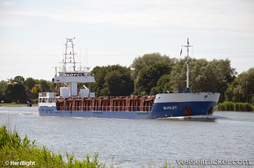
Marley
Current StatusWhere is the vessel?
Marley is currently in Near Lillo, based on AIS data received about 1h ago.
Latest AIS update:
Current position: 51.30768° N, 4.32535° E (Near Lillo)
Average speed (last 7 days): Loading…
Average speed (last 30 days): Loading…
Vessel profile: Marley is a Multi Purpose Carrier with dimensions 11m x 91m.
This page combines live AIS, route history, probable destination signals, nearby traffic, and port activity for practical vessel monitoring.
The current position of vessel Marley is 51.30768 lat / 4.32535 lng. Updated: 2026-04-17 17:23:30 UTCNearest reference points:
- Near Kallo
- Near Doel
- Near Antwerp
Details:
Live Vessel Marley Analytics (details, animations, etc.)
Recent AIS points (UTC):
2026-04-17 12:23:33 UTC · 51.30768, 4.32532 · SOG 0.1 kn · COG 285°2026-04-17 14:20:32 UTC · 51.30768, 4.32535 · SOG 0 kn · COG 285°
2026-04-17 15:59:29 UTC · 51.30768, 4.32533 · SOG 0.1 kn · COG 286°
2026-04-17 17:23:30 UTC · 51.30768, 4.32535 · SOG 0 kn · COG 286°