 vesseltracker.com
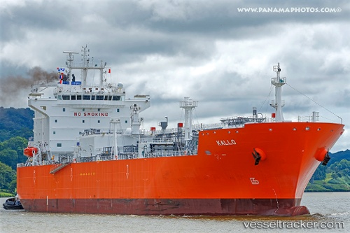
 Kallo
Kallo
Current Status
Where is the vessel?
Kallo is currently in 49 nm SW of Campohermoso, based on AIS data received less than 1h ago.
Latest AIS update:
Current position: 36.39500° N, 23.55333° W (49 nm SW of Campohermoso)
Average speed (last 7 days): Loading…
Average speed (last 30 days): Loading…
Vessel profile: Kallo is a Lpg Tanker with dimensions 180m x 180m.
This page combines live AIS, route history, probable destination signals, nearby traffic, and port activity for practical vessel monitoring.
The current position of vessel Kallo is 36.39500 lat / -23.55333 lng. Updated: 2026-03-30 09:51:29 UTCNearest reference points:
- 52 nm S of Campohermoso
- 48 nm S of Villa Do Porto
- 68 nm NE of Campohermoso
Currently sailing under the flag of Belgium ![]()
Details:
Live Vessel Kallo Analytics (details, animations, etc.)
Recent AIS points (UTC):
2026-03-30 03:35:05 UTC · 36.34992, -25.24903 · SOG 12.8 kn · COG 87°2026-03-30 05:45:25 UTC · 36.36392, -24.65898 · SOG 13 kn · COG 89°
2026-03-30 07:52:43 UTC · 36.37780, -24.09218 · SOG 12.8 kn · COG 89°
2026-03-30 09:51:29 UTC · 36.39500, -23.55333 · SOG 13 kn · COG -1°