 vesseltracker.com
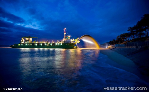
Marieke
Current StatusWhere is the vessel?
Marieke is currently in Near TAICHUNG, based on AIS data received about 1h ago.
Latest AIS update:
Current position: 24.25000° N, 120.48173° E (Near TAICHUNG)
Average speed (last 7 days): Loading…
Average speed (last 30 days): Loading…
Vessel profile: Marieke is a Hopper Dredger with dimensions 22m x 98m.
This page combines live AIS, route history, probable destination signals, nearby traffic, and port activity for practical vessel monitoring.
The current position of vessel Marieke is 24.25000 lat / 120.48173 lng. Updated: 2026-04-09 08:15:06 UTCNearest reference points:
- Near TAICHUNG
- Near Tai-tung Kang
- Near Miao-li
Details:
Live Vessel Marieke Analytics (details, animations, etc.)
Recent AIS points (UTC):
2026-04-09 02:27:35 UTC · 24.24540, 120.47957 · SOG 1.3 kn · COG 195°2026-04-09 03:54:06 UTC · 24.24574, 120.48060 · SOG 1.5 kn · COG 28°
2026-04-09 06:18:46 UTC · 24.24919, 120.48112 · SOG 1.4 kn · COG 208°
2026-04-09 08:15:06 UTC · 24.25000, 120.48173 · SOG 2 kn · COG 212°