 vesseltracker.com
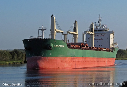
Labrador
Current StatusWhere is the vessel?
Labrador is currently in Near Port Weller, based on AIS data received about 16h ago.
Latest AIS update:
Current position: 43.22739° N, 79.28795° W (Near Port Weller)
Average speed (last 7 days): Loading…
Average speed (last 30 days): Loading…
Vessel profile: Labrador is a Bulk Carrier with dimensions 23m x 186m.
This page combines live AIS, route history, probable destination signals, nearby traffic, and port activity for practical vessel monitoring.
The current position of vessel Labrador is 43.22739 lat / -79.28795 lng. Updated: 2026-04-10 07:44:37 UTCNearest reference points:
- Near OAKVILLE
- Near TORONTO
- Near Hannon
Details:
Live Vessel Labrador Analytics (details, animations, etc.)
Recent AIS points (UTC):
2026-04-10 02:17:40 UTC · 43.22901, -79.28930 · SOG 0 kn · COG 203°2026-04-10 04:18:17 UTC · 43.22500, -79.28833 · SOG 0 kn · COG -1°
2026-04-10 06:23:40 UTC · 43.22731, -79.28792 · SOG 0.1 kn · COG 263°
2026-04-10 07:44:37 UTC · 43.22739, -79.28795 · SOG 0 kn · COG 257°