 vesseltracker.com
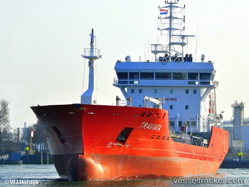
 Traviata
Current Status
Where is the vessel?
Traviata is currently in Near Rilland, based on AIS data received about 1h ago.
Latest AIS update:
Current position: 51.38680° N, 4.16372° E (Near Rilland)
Average speed (last 7 days): Loading…
Average speed (last 30 days): Loading…
Vessel profile: Traviata is a Chemical Oil Products Tanker with dimensions 104m x 104m.
This page combines live AIS, route history, probable destination signals, nearby traffic, and port activity for practical vessel monitoring.
The current position of vessel Traviata is 51.38680 lat / 4.16372 lng. Updated: 2026-03-29 01:23:07 UTCNearest reference points:
- Near Rilland
- Near Verrebroek
- Near Doel
Currently sailing under the flag of Cyprus ![]()
Details:
Live Vessel Traviata Analytics (details, animations, etc.)
Recent AIS points (UTC):
2026-03-28 19:34:30 UTC · 51.25901, 4.36268 · SOG 0 kn · COG 271°2026-03-28 21:34:30 UTC · 51.25905, 4.36262 · SOG 0 kn · COG 271°
2026-03-29 00:15:45 UTC · 51.27743, 4.33313 · SOG 0 kn · COG 318°
2026-03-29 01:23:07 UTC · 51.38680, 4.16372 · SOG 13.9 kn · COG 227°