 vesseltracker.com
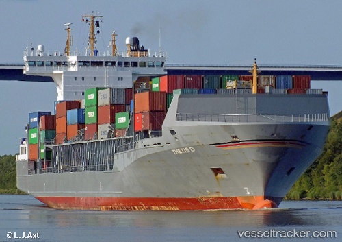
Thetis D
Current StatusWhere is the vessel?
Thetis D is currently in Near Bünsdorf, based on AIS data received about 1h ago.
Latest AIS update:
Current position: 54.36100° N, 9.79100° E (Near Bünsdorf)
Average speed (last 7 days): Loading…
Average speed (last 30 days): Loading…
Vessel profile: Thetis D is a Container Ship with dimensions 26m x 168m.
This page combines live AIS, route history, probable destination signals, nearby traffic, and port activity for practical vessel monitoring.
The current position of vessel Thetis D is 54.36100 lat / 9.79100 lng. Updated: 2026-03-30 18:04:16 UTCNearest reference points:
- Near BORGSTEDT
- Near Borgwedel
- Near Fahrdorf
Details:
Live Vessel Thetis D Analytics (details, animations, etc.)
Recent AIS points (UTC):
2026-03-30 12:15:54 UTC · 53.89850, 9.15483 · SOG 4.5 kn · COG 44°2026-03-30 13:51:05 UTC · 54.03851, 9.30377 · SOG 5.6 kn · COG 9°
2026-03-30 15:30:56 UTC · 54.17700, 9.45833 · SOG 6.8 kn · COG 70°
2026-03-30 18:04:16 UTC · 54.36100, 9.79100 · SOG 6.7 kn · COG 68°