 vesseltracker.com
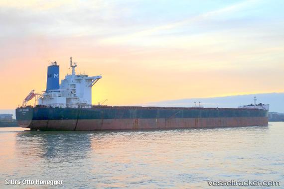
 Cape Breeze
Current Status
Where is the vessel?
Cape Breeze is currently in 203 nm NE of Tamatave, based on AIS data received less than 1h ago.
Latest AIS update:
Current position: 15.77810° S, 51.94122° E (203 nm NE of Tamatave)
Average speed (last 7 days): Loading…
Average speed (last 30 days): Loading…
Vessel profile: Cape Breeze is a Bulk Carrier with dimensions 292m x 45m.
This page combines live AIS, route history, probable destination signals, nearby traffic, and port activity for practical vessel monitoring.
The current position of vessel Cape Breeze is -15.77810 lat / 51.94122 lng. Updated: 2026-04-05 23:33:44 UTCNearest reference points:
- 210 nm NE of Tamatave
- 243 nm E of Nosy-Be
- 183 nm E of Tamatave
Currently sailing under the flag of Cyprus ![]()
Cape Breeze built in 2010 year
Deadweight:
180203 tDetails:
Live Vessel Cape Breeze Analytics (details, animations, etc.)
Recent AIS points (UTC):
2026-04-05 13:23:39 UTC · -15.94443, 51.99178 · SOG 1.2 kn · COG 93°2026-04-05 16:07:00 UTC · -15.89070, 51.98853 · SOG 1.3 kn · COG 91°
2026-04-05 21:06:05 UTC · -15.81218, 51.95475 · SOG 0.8 kn · COG 88°
2026-04-05 23:33:44 UTC · -15.77810, 51.94122 · SOG 0.8 kn · COG 80°