 vesseltracker.com
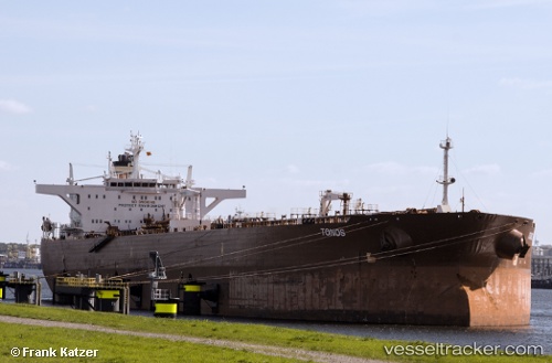
 CECILIA A
Current Status
Where is the vessel?
CECILIA A is currently in Near Taboguilla, based on AIS data received about 1157d ago.
Latest AIS update:
Current position: 8.82248° N, 79.49215° W (Near Taboguilla)
Average speed (last 7 days): Loading…
Average speed (last 30 days): Loading…
Vessel profile: CECILIA A is a Crude Oil Tanker with dimensions 274m x 48m.
This page combines live AIS, route history, probable destination signals, nearby traffic, and port activity for practical vessel monitoring.
The current position of vessel CECILIA A is 8.82248 lat / -79.49215 lng. Updated: 2023-01-27 15:36:51 UTCNearest reference points:
- Near Panama
- Near El Chorrillo
- Near Melones
Currently sailing under the flag of Cyprus ![]()
CECILIA A built in 2003 year
Deadweight:
159996 tDetails:
Live Vessel CECILIA A Analytics (details, animations, etc.)
Recent AIS points (UTC):
2023-01-27 15:36:51 UTC · 8.82248, -79.49215 · SOG 0.1 kn · COG 18°