 vesseltracker.com
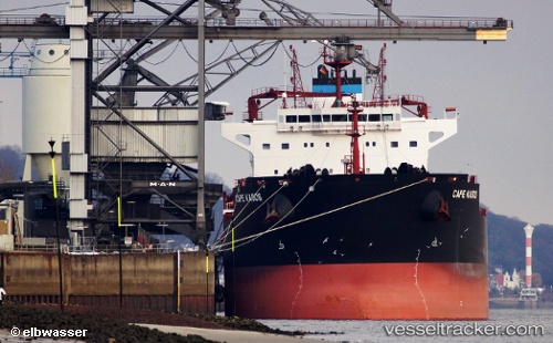
Cape Kasos
Current StatusWhere is the vessel?
Cape Kasos is currently in 213 nm W of Villa Elisa, based on AIS data received about 1d ago.
Latest AIS update:
Current position: 25.63879° N, 61.53226° W (213 nm W of Villa Elisa)
Average speed (last 7 days): Loading…
Average speed (last 30 days): Loading…
Vessel profile: Cape Kasos is a Bulk Carrier with dimensions 32m x 229m.
This page combines live AIS, route history, probable destination signals, nearby traffic, and port activity for practical vessel monitoring.
The current position of vessel Cape Kasos is 25.63879 lat / -61.53226 lng. Updated: 2026-04-10 07:33:31 UTCNearest reference points:
- 328 nm W of Villa Elisa
Details:
Live Vessel Cape Kasos Analytics (details, animations, etc.)
Recent AIS points (UTC):
2026-04-10 01:22:35 UTC · 26.46043, -62.26640 · SOG 10 kn · COG 139°2026-04-10 03:49:15 UTC · 26.14172, -61.97385 · SOG 10.2 kn · COG 140°
2026-04-10 05:28:54 UTC · 25.91598, -61.78510 · SOG 10.2 kn · COG 144°
2026-04-10 07:33:31 UTC · 25.63879, -61.53226 · SOG 10.6 kn · COG 140°