 vesseltracker.com
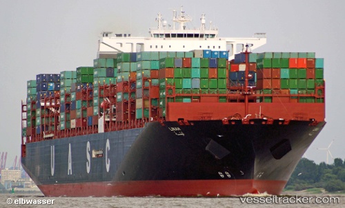
 LINAH
LINAH
Current Status
Where is the vessel?
LINAH is currently in 156 nm S of Xijiang, based on AIS data received about 1h ago.
Latest AIS update:
Current position: 18.67992° N, 114.90495° E (156 nm S of Xijiang)
Average speed (last 7 days): Loading…
Average speed (last 30 days): Loading…
Vessel profile: LINAH is a Cargo with dimensions m x m.
This page combines live AIS, route history, probable destination signals, nearby traffic, and port activity for practical vessel monitoring.
The current position of vessel LINAH is 18.67992 lat / 114.90495 lng. Updated: 2026-04-21 16:29:52 UTCNearest reference points:
- 123 nm S of Shadi
- 78 nm SW of Xijiang
- 60 nm SE of Shadi
Currently sailing under the flag of Germany ![]()
Details:
Live Vessel LINAH Analytics (details, animations, etc.)
Recent AIS points (UTC):
2026-04-21 11:12:26 UTC · 17.42712, 114.12752 · SOG 16.5 kn · COG -1°2026-04-21 13:28:44 UTC · 17.96476, 114.47635 · SOG 16.5 kn · COG -1°
2026-04-21 16:23:58 UTC · 18.65694, 114.89047 · SOG 16.1 kn · COG 29°
2026-04-21 16:29:52 UTC · 18.67992, 114.90495 · SOG 16.3 kn · COG 29°