 vesseltracker.com
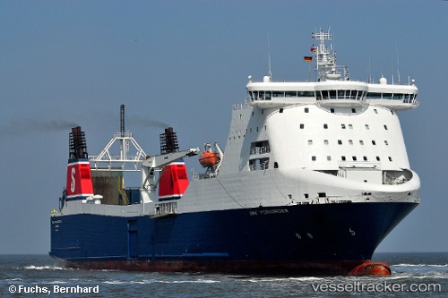
 Msc Bridge
Current Status
Where is the vessel?
Msc Bridge is currently in 20 nm NE of Al Marsá, based on AIS data received less than 1h ago.
Latest AIS update:
Current position: 37.08556° N, 10.66136° E (20 nm NE of Al Marsá)
Average speed (last 7 days): Loading…
Average speed (last 30 days): Loading…
Vessel profile: Msc Bridge is a Ro Ro Cargo Ship with dimensions 182m x 30m.
This page combines live AIS, route history, probable destination signals, nearby traffic, and port activity for practical vessel monitoring.
The current position of vessel Msc Bridge is 37.08556 lat / 10.66136 lng. Updated: 2026-04-02 00:11:07 UTCNearest reference points:
- 13 nm N of Qulaybiyah
- Near Le Kram
- 32 nm N of Qulaybiyah
Currently sailing under the flag of Cyprus ![]()
Msc Bridge built in 1998 year
Deadweight:
12350 tDetails:
Live Vessel Msc Bridge Analytics (details, animations, etc.)
Recent AIS points (UTC):
2026-04-01 17:32:38 UTC · 37.34259, 11.70001 · SOG 12.6 kn · COG 295°2026-04-01 19:42:26 UTC · 37.48218, 11.15119 · SOG 12.2 kn · COG 290°
2026-04-01 22:05:45 UTC · 37.55888, 10.56823 · SOG 12.3 kn · COG 280°
2026-04-02 00:11:07 UTC · 37.08556, 10.66136 · SOG 15.4 kn · COG 180°