 vesseltracker.com
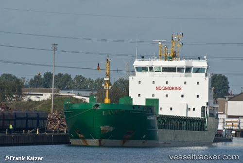
 Halland
Current Status
Where is the vessel?
Halland is currently in 12 nm NW of Vikati Sadam, based on AIS data received about 1h ago.
Latest AIS update:
Current position: 58.44290° N, 21.52650° E (12 nm NW of Vikati Sadam)
Average speed (last 7 days): Loading…
Average speed (last 30 days): Loading…
Vessel profile: Halland is a Multi Purpose Carrier with dimensions 119m x 16m.
This page combines live AIS, route history, probable destination signals, nearby traffic, and port activity for practical vessel monitoring.
The current position of vessel Halland is 58.44290 lat / 21.52650 lng. Updated: 2026-04-22 11:05:08 UTCNearest reference points:
- 20 nm W of Kalana
- 18 nm N of Ventspils
- 37 nm W of Vikati Sadam
Currently sailing under the flag of Cyprus ![]()
Halland built in 2008 year
Deadweight:
6795 tDetails:
Live Vessel Halland Analytics (details, animations, etc.)
Recent AIS points (UTC):
2026-04-22 07:05:05 UTC · 59.02907, 22.06287 · SOG 9.9 kn · COG 242°2026-04-22 08:03:05 UTC · 58.93032, 21.82242 · SOG 9.6 kn · COG 228°
2026-04-22 09:25:02 UTC · 58.71625, 21.67540 · SOG 10.3 kn · COG 196°
2026-04-22 11:05:08 UTC · 58.44290, 21.52650 · SOG 10.4 kn · COG 198°