 vesseltracker.com
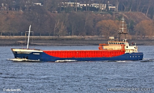
 Francisca
Current Status
Where is the vessel?
Francisca is currently in 12 nm N of Hijum, based on AIS data received about 1h ago.
Latest AIS update:
Current position: 53.50332° N, 4.77093° E (12 nm N of Hijum)
Average speed (last 7 days): Loading…
Average speed (last 30 days): Loading…
Vessel profile: Francisca is a Multi Purpose Carrier with dimensions 89m x 12m.
This page combines live AIS, route history, probable destination signals, nearby traffic, and port activity for practical vessel monitoring.
The current position of vessel Francisca is 53.50332 lat / 4.77093 lng. Updated: 2026-04-18 19:23:06 UTCNearest reference points:
- Near Molengat
- Near de Waal
- Near OUDESCHILD
Currently sailing under the flag of Cyprus ![]()
Francisca built in 1997 year
Deadweight:
3452 tDetails:
Live Vessel Francisca Analytics (details, animations, etc.)
Recent AIS points (UTC):
2026-04-18 14:02:34 UTC · 52.59903, 4.00460 · SOG 10.6 kn · COG 33°2026-04-18 16:24:56 UTC · 52.99652, 4.37215 · SOG 11.8 kn · COG 25°
2026-04-18 17:33:25 UTC · 53.19662, 4.52924 · SOG 11.7 kn · COG 21°
2026-04-18 19:23:06 UTC · 53.50332, 4.77093 · SOG 10.4 kn · COG 14°