 vesseltracker.com
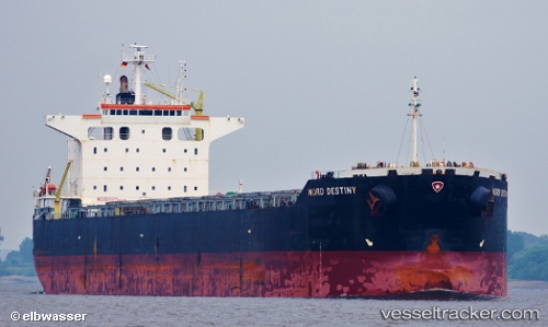
 IOLE R
Current Status
Where is the vessel?
IOLE R is currently in 14 nm S of ILHA GUAIBA, based on AIS data received about 1h ago.
Latest AIS update:
Current position: 23.24820° S, 43.98295° W (14 nm S of ILHA GUAIBA)
Average speed (last 7 days): Loading…
Average speed (last 30 days): Loading…
Vessel profile: IOLE R is a Bulk Carrier with dimensions m x m.
This page combines live AIS, route history, probable destination signals, nearby traffic, and port activity for practical vessel monitoring.
The current position of vessel IOLE R is -23.24820 lat / -43.98295 lng. Updated: 2026-04-18 20:06:29 UTCNearest reference points:
- Near ILHA GUAIBA
- Near SANTA RITA
- Near CUNHAMBEBE
Currently sailing under the flag of Cyprus ![]()
Details:
Live Vessel IOLE R Analytics (details, animations, etc.)
Recent AIS points (UTC):
2026-04-18 14:17:20 UTC · -23.32493, -43.91460 · SOG 0.3 kn · COG 75°2026-04-18 15:41:17 UTC · -23.32408, -43.91388 · SOG 0 kn · COG 120°
2026-04-18 18:23:15 UTC · -23.32408, -43.91398 · SOG 0.3 kn · COG 118°
2026-04-18 20:06:29 UTC · -23.24820, -43.98295 · SOG 0.8 kn · COG 330°