 vesseltracker.com
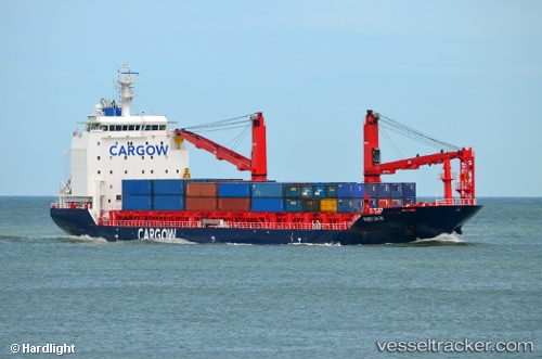
Vessel Freyja W IMO: 9754422, MMSI: 212792000 Multi Purpose Carrier
UTC, 59.73667, -4.88333, course: -1, speed: 14
UTC, 59.37189, -4.30686, course: 147, speed: 14.4
2026-02-13 20:02:45 UTC, 58.92422, -3.66711, course: 145, speed: 14.7
Live AIS position:
UTC. 11 nm W of Moaness, Hoy),
updated 2026-02-13 20:02:45 UTC.
Find the position of the vessel Freyja W on the map. The latter are known coordinates and path.
marine traffic ship tracker show on live map
The current position of vessel Freyja W is 58.92422 lat / -3.66711 lng. Updated: 2026-02-13 20:02:45 UTCCurrently sailing under the flag of Cyprus
Details:
Last coordinates of the vessel:
UTC, 60.18667, -5.57333, course: -1, speed: 14UTC, 59.73667, -4.88333, course: -1, speed: 14
UTC, 59.37189, -4.30686, course: 147, speed: 14.4
2026-02-13 20:02:45 UTC, 58.92422, -3.66711, course: 145, speed: 14.7