 vesseltracker.com
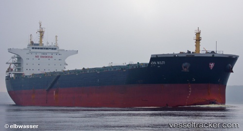
 THALIA
Current Status
Where is the vessel?
THALIA is currently in 39 nm NE of Neeltje Jans, based on AIS data received less than 1h ago.
Latest AIS update:
Current position: 53.97492° N, 4.63452° E (39 nm NE of Neeltje Jans)
Average speed (last 7 days): Loading…
Average speed (last 30 days): Loading…
Vessel profile: THALIA is a Bulk Carrier with dimensions m x m.
This page combines live AIS, route history, probable destination signals, nearby traffic, and port activity for practical vessel monitoring.
The current position of vessel THALIA is 53.97492 lat / 4.63452 lng. Updated: 2026-04-18 06:16:56 UTCNearest reference points:
- Near Molengat
- Near Neeltje Jans
- Near de Waal
Currently sailing under the flag of Cyprus ![]()
Details:
Live Vessel THALIA Analytics (details, animations, etc.)
Recent AIS points (UTC):
2026-04-18 00:00:40 UTC · 52.84453, 3.86906 · SOG 13.6 kn · COG 317°2026-04-18 02:30:17 UTC · 53.33874, 3.63720 · SOG 14.5 kn · COG 26°
2026-04-18 04:12:29 UTC · 53.64354, 4.06008 · SOG 13.8 kn · COG -1°
2026-04-18 06:16:56 UTC · 53.97492, 4.63452 · SOG 13.8 kn · COG 16°