 vesseltracker.com
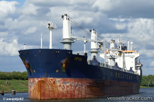
 Iryda
Iryda
Current Status
Where is the vessel?
Iryda is currently in Near Waterport, based on AIS data received about 1d ago.
Latest AIS update:
Current position: 36.14150° N, 5.36668° W (Near Waterport)
Average speed (last 7 days): Loading…
Average speed (last 30 days): Loading…
Vessel profile: Iryda is a Bulk Carrier with dimensions 200m x 23m.
This page combines live AIS, route history, probable destination signals, nearby traffic, and port activity for practical vessel monitoring.
The current position of vessel Iryda is 36.14150 lat / -5.36668 lng. Updated: 2026-04-10 08:04:41 UTCNearest reference points:
- Near Waterport
- Near La Línea de la Concepción
- Near Palmones
Currently sailing under the flag of Cyprus ![]()
Iryda built in 1999 year
Deadweight:
34946 tDetails:
Live Vessel Iryda Analytics (details, animations, etc.)
Recent AIS points (UTC):
2026-04-10 02:37:19 UTC · 36.14825, -5.36608 · SOG 0 kn · COG 182°2026-04-10 04:19:18 UTC · 36.14823, -5.36610 · SOG 0 kn · COG 182°
2026-04-10 05:26:19 UTC · 36.14822, -5.36612 · SOG 0 kn · COG 182°
2026-04-10 08:04:41 UTC · 36.14150, -5.36668 · SOG 0 kn · COG 342°