 vesseltracker.com
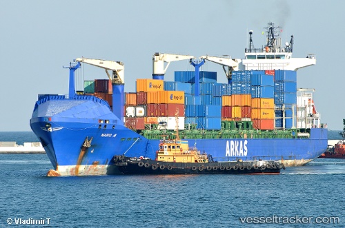
Vessel Mario A IMO: 9337377, MMSI: 215177000 Container Ship
UTC, 31.2183, 29.687, course: 350, speed: 0.1
UTC, 31.2182, 29.6871, course: 344, speed: 0.2
2026-02-28 07:33:16 UTC, 31.2183, 29.6871, course: 350, speed: 0.2
Live AIS position:
UTC. Near EL DEKHEILA),
updated 2026-02-28 07:33:16 UTC.
Find the position of the vessel Mario A on the map. The latter are known coordinates and path.
marine traffic ship tracker show on live map
The current position of vessel Mario A is 31.2183 lat / 29.6871 lng. Updated: 2026-02-28 07:33:16 UTCCurrently sailing under the flag of Malta
Mario A built in 2007 year
Deadweight:
22016 tDetails:
Last coordinates of the vessel:
UTC, 31.2185, 29.6878, course: 327, speed: 0.1UTC, 31.2183, 29.687, course: 350, speed: 0.1
UTC, 31.2182, 29.6871, course: 344, speed: 0.2
2026-02-28 07:33:16 UTC, 31.2183, 29.6871, course: 350, speed: 0.2