 vesseltracker.com
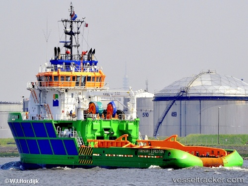
 BOKA EXPEDITION
Current Status
Where is the vessel?
BOKA EXPEDITION is currently in Near HAMBANTOTA, based on AIS data received less than 1h ago.
Latest AIS update:
Current position: 6.08020° N, 81.09780° E (Near HAMBANTOTA)
Average speed (last 7 days): Loading…
Average speed (last 30 days): Loading…
Vessel profile: BOKA EXPEDITION is a Anchor Hoy with dimensions 18m x 75m.
This page combines live AIS, route history, probable destination signals, nearby traffic, and port activity for practical vessel monitoring.
The current position of vessel BOKA EXPEDITION is 6.0802 lat / 81.0978 lng. Updated: 2026-04-02 06:21:45 UTCNearest reference points:
- Near HAMBANTOTA
- 15 nm S of Koggala
- 40 nm E of Konwelana
Currently sailing under the flag of Malta ![]()
BOKA EXPEDITION built in 2007 year
Deadweight:
3567 tDetails:
Live Vessel BOKA EXPEDITION Analytics (details, animations, etc.)
Recent AIS points (UTC):
2026-04-01 23:56:33 UTC · 5.94833, 81.28670 · SOG 0 kn · COG -1°2026-04-02 01:23:31 UTC · 5.94833, 81.28670 · SOG 0 kn · COG -1°
2026-04-02 03:23:34 UTC · 5.98106, 81.23570 · SOG 9.6 kn · COG 307°
2026-04-02 06:21:45 UTC · 6.08020, 81.09780 · SOG 0.5 kn · COG 74°