 vesseltracker.com
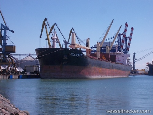
 Yellow Fin
Current Status
Where is the vessel?
Yellow Fin is currently in Near La Plata, based on AIS data received about 1h ago.
Latest AIS update:
Current position: 34.72150° S, 57.84900° W (Near La Plata)
Average speed (last 7 days): Loading…
Average speed (last 30 days): Loading…
Vessel profile: Yellow Fin is a Bulk Carrier with dimensions 190m x 31m.
This page combines live AIS, route history, probable destination signals, nearby traffic, and port activity for practical vessel monitoring.
The current position of vessel Yellow Fin is -34.7215 lat / -57.849 lng. Updated: 2026-04-21 16:11:34 UTCNearest reference points:
- Near JUAN LACAZE
- Near Dock Sur
- Near Avellaneda
Currently sailing under the flag of Malta ![]()
Yellow Fin built in 2011 year
Deadweight:
56780 tDetails:
Live Vessel Yellow Fin Analytics (details, animations, etc.)
Recent AIS points (UTC):
2026-04-21 13:40:37 UTC · -34.60390, -58.24490 · SOG 10 kn · COG 141°2026-04-21 13:45:06 UTC · -34.61280, -58.23410 · SOG 9.7 kn · COG 107°
2026-04-21 15:53:29 UTC · -34.72250, -57.84890 · SOG 1.6 kn · COG 258°
2026-04-21 16:11:34 UTC · -34.72150, -57.84900 · SOG 0 kn · COG 310°