 vesseltracker.com
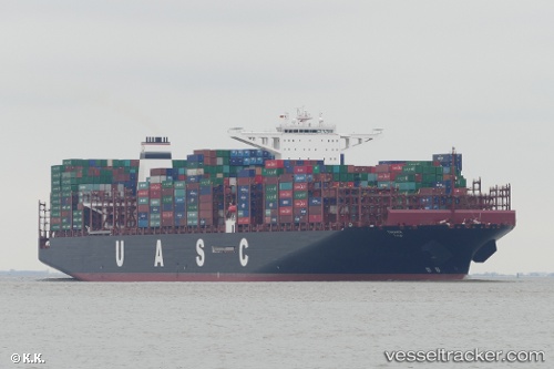
 TIHAMA
Current Status
Where is the vessel?
TIHAMA is currently in 86 nm SE of Konwelana, based on AIS data received about 1h ago.
Latest AIS update:
Current position: 5.60145° N, 82.57480° E (86 nm SE of Konwelana)
Average speed (last 7 days): Loading…
Average speed (last 30 days): Loading…
Vessel profile: TIHAMA is a Cargo A with dimensions m x m.
This page combines live AIS, route history, probable destination signals, nearby traffic, and port activity for practical vessel monitoring.
The current position of vessel TIHAMA is 5.60145 lat / 82.5748 lng. Updated: 2026-04-16 19:56:01 UTCNearest reference points:
- 75 nm E of Konwelana
- 79 nm E of Konwelana
- 53 nm SE of Konwelana
Currently sailing under the flag of Germany ![]()
Details:
Live Vessel TIHAMA Analytics (details, animations, etc.)
Recent AIS points (UTC):
2026-04-16 12:19:56 UTC · 5.54264, 80.68370 · SOG 14.9 kn · COG 91°2026-04-16 14:22:14 UTC · 5.55203, 81.19260 · SOG 14.9 kn · COG 96°
2026-04-16 16:02:52 UTC · 5.54306, 81.60050 · SOG 14.8 kn · COG -1°
2026-04-16 19:56:01 UTC · 5.60145, 82.57480 · SOG 15.2 kn · COG 89°