 vesseltracker.com
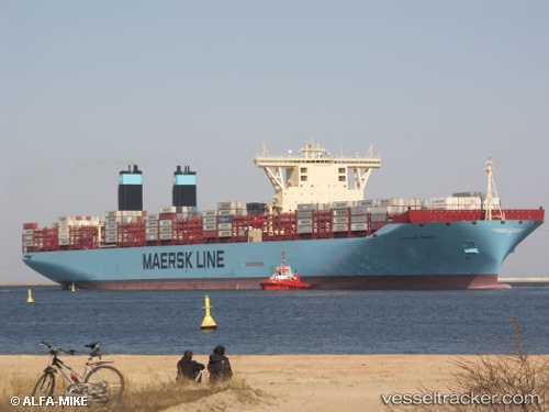
Magleby Maersk
Current StatusWhere is the vessel?
Magleby Maersk is currently in 29 nm NW of Villanueva de Lorenzana, based on AIS data received less than 1h ago.
Latest AIS update:
Current position: 43.87465° N, 9.65578° W (29 nm NW of Villanueva de Lorenzana)
Average speed (last 7 days): Loading…
Average speed (last 30 days): Loading…
Vessel profile: Magleby Maersk is a Container Ship with dimensions 60m x 399m.
This page combines live AIS, route history, probable destination signals, nearby traffic, and port activity for practical vessel monitoring.
The current position of vessel Magleby Maersk is 43.87465 lat / -9.65578 lng. Updated: 2026-04-08 20:01:56 UTCNearest reference points:
- 13 nm NE of Villanueva de Lorenzana
- 30 nm NW of Meiras-Valdoviño
- Near PUNTA LANGOSTEIRA
Details:
Live Vessel Magleby Maersk Analytics (details, animations, etc.)
Recent AIS points (UTC):
2026-04-08 14:13:55 UTC · 45.41444, -8.44386 · SOG 18.1 kn · COG 213°2026-04-08 16:10:19 UTC · 44.90515, -8.85678 · SOG 18.2 kn · COG 210°
2026-04-08 17:42:55 UTC · 44.49090, -9.17887 · SOG 18.3 kn · COG 210°
2026-04-08 20:01:56 UTC · 43.87465, -9.65578 · SOG 18.1 kn · COG 211°