 vesseltracker.com
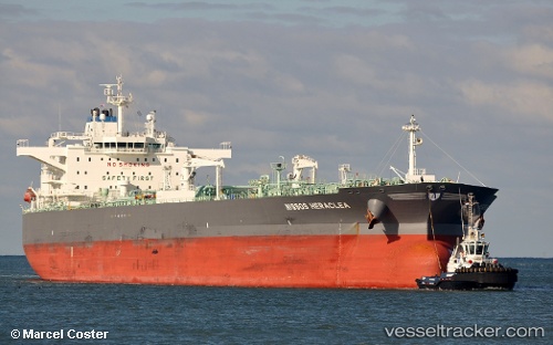
 TORM KIARA
Current Status
Where is the vessel?
TORM KIARA is currently in 52 nm SW of Fluminense FPSO, based on AIS data received about 1h ago.
Latest AIS update:
Current position: 23.39452° S, 40.88222° W (52 nm SW of Fluminense FPSO)
Average speed (last 7 days): Loading…
Average speed (last 30 days): Loading…
Vessel profile: TORM KIARA is a Crude Oil Tanker with dimensions 45m x 252m.
This page combines live AIS, route history, probable destination signals, nearby traffic, and port activity for practical vessel monitoring.
The current position of vessel TORM KIARA is -23.39452 lat / -40.88222 lng. Updated: 2026-04-18 03:19:05 UTCNearest reference points:
- 47 nm E of Arraial do Cabo
- Near Fluminense FPSO
- 24 nm SE of Carapebus
Currently sailing under the flag of Denmark (DIS) ![]()
TORM KIARA built in 2015 year
Deadweight:
114270 tDetails:
Live Vessel TORM KIARA Analytics (details, animations, etc.)
Recent AIS points (UTC):
2026-04-17 22:11:57 UTC · -23.32446, -40.77478 · SOG 1.2 kn · COG 181°2026-04-18 00:13:09 UTC · -23.34519, -40.81992 · SOG 1.5 kn · COG 191°
2026-04-18 02:06:08 UTC · -23.37323, -40.85972 · SOG 1.5 kn · COG 180°
2026-04-18 03:19:05 UTC · -23.39452, -40.88222 · SOG 1.4 kn · COG 176°