 vesseltracker.com
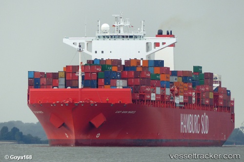
 Cap San Marco
Current Status
Where is the vessel?
Cap San Marco is currently in 29 nm N of Bear River City, based on AIS data received less than 1h ago.
Latest AIS update:
Current position: 42.07333° N, 11.54833° W (29 nm N of Bear River City)
Average speed (last 7 days): Loading…
Average speed (last 30 days): Loading…
Vessel profile: Cap San Marco is a Container Ship with dimensions 333m x 48m.
This page combines live AIS, route history, probable destination signals, nearby traffic, and port activity for practical vessel monitoring.
The current position of vessel Cap San Marco is 42.07333 lat / -11.54833 lng. Updated: 2026-04-20 06:01:08 UTCNearest reference points:
- 20 nm SE of Bear River City
- 25 nm S of Bear River City
- 40 nm NW of Sarinena
Currently sailing under the flag of Denmark ![]()
Cap San Marco built in 2013 year
Deadweight:
124453 tDetails:
Live Vessel Cap San Marco Analytics (details, animations, etc.)
Recent AIS points (UTC):
2026-04-20 01:49:21 UTC · 43.01547, -10.86387 · SOG 15.6 kn · COG 209°2026-04-20 04:03:44 UTC · 42.50857, -11.22395 · SOG 15.2 kn · COG 208°
2026-04-20 04:18:56 UTC · 42.45208, -11.26557 · SOG 15.1 kn · COG 209°
2026-04-20 06:01:08 UTC · 42.07333, -11.54833 · SOG 15 kn · COG -1°